Hiking in Urho Kekkonen National Park – Trails and Accommodation in Saariselkä
Urho Kekkonen National Park is one of Finland’s most popular and versatile destinations for outdoor activities. The Saariselkä area is surrounded by an extensive network of marked hiking trails, a significant part of which run through Urho Kekkonen National Park. The trails cater to everyone, from a few hours’ day hike to a multi-day wilderness trek. Staying at Kuukkeli’s accommodation in Saariselkä is a natural base: the gateway to the national park is within walking distance.
What is Urho Kekkonen National Park?
Urho Kekkonen National Park was established in 1983. Its area is approximately 2,550 square kilometres, making it the second largest national park in Finland after Lemmenjoki National Park. The park is located in eastern Lapland, in the municipalities of Inari, Sodankylä and Savukoski, and borders Russia to the east.
Saariselkä is the park’s most popular gateway. Other important starting points are Kiilopää, approximately 15 kilometres south of Saariselkä, as well as Tankavaara, Aittajärvi and Raja-Jooseppi. The park’s characteristic landscapes range from open fell scenery to mountain birch forests, clear stream valleys and vast aapa mires.
Hiking trails from Saariselkä: routes for every level
The trails starting from the Saariselkä and Kiilopää gateways are the best known and most accessible in the UKK park. Here is an overview of the most popular routes, from the shortest to the longest.
Aurora Trail – 2.1 km (easy)
The Aurora Trail starts at the Saariselkä trailhead at the end of Lutontie road. The route is illuminated and has an Aurora day hut and an outdoor fireplace along the way. Suitable for everyone, including families with children.
Iisakkipää route – 3 or 7 km (moderate)
The Iisakkipää route starts from the Saariselkä gateway. The route offers two options: the shorter 3 km version explores the gorge scenery lower on the fell, while the longer 7 km route climbs to the top of Iisakkipää. There are no campfire spots along the route.
Kiirunapolku – 6 km (moderate)
Starting from the Kiilopää gateway, Kiirunapolku leads to the summit of Kiilopää with unforgettable fell panoramas. The route can also be walked in winter with snowshoes.
Rumakuru – 14 km (demanding)
Rumakuru is a loop trail starting from the Saariselkä gateway, passing through a steep-walled gorge shaped by the Ice Age. The Rumakuru day hut is approximately 6 kilometres from the start, and the return route goes via the summit of Vävypää and the Piispanoja campfire shelter. The total distance is 14 km and the estimated duration is 4–6 hours.
Ahopää loop trail – 14 km (intermediate)
Starting from the Kiilopää gateway, the Ahopää route is a scenic trail with views of Ice Age formations and open fell landscapes. There is a rest stop at the Luulampi day hut, which operates a café during the season.
Rautulampi loop – 22 km (demanding)
The Rautulampi loop is one of the classics of the UKK park. The route starts from the Kiilopää gateway (Kiilopääntie 620, Saariselkä) and circles through Rautulampi to Niilanpää and back. The total distance is 22 km with significant elevation changes. The Rautulampi open and bookable wilderness hut is modern and well equipped, with a sauna. There are rest stops and campfire sites at regular intervals along the route. The recommended direction is clockwise.
The Luirojärvi trek – a classic for the experienced hiker
The Luirojärvi trek is the most well-known multi-day hike in the UKK park. The route starts from Kiilopää and winds through the heart of the park to Lake Luirojärvi, from where you can also summit Sokosti (718 m), the highest fell in Urho Kekkonen National Park. The loop is 70–80 kilometres long and typically takes 5–7 days to complete. The route is not marked in the terrain, so navigation skills are required.
A typical hut-to-hut route going counter-clockwise runs as follows: Kiilopää – Suomunruoktu (approx. 14 km) – Tuiskukuru (approx. 13 km) – Luirojärvi (approx. 8 km) – day trip to Sokosti (approx. 13 km return) – Lankojärvi (approx. 19 km) – Kiilopää (approx. 16 km). The park has 37 Metsähallitus-maintained wilderness huts and cabins, of which the open huts are free of charge. Bookable hut beds can be reserved in advance at Eräluvat.fi.
The route passes several special sights: Paratiisikuru gorge, Pirunportti, the historic reindeer-herding fence at Niilanpää and Raappanan kammi. Fell stream water is widely used as drinking water, but water quality should always be assessed case by case.

Hiking in Saariselkä all year round
The UKK park is suitable for outdoor activities in all seasons, though what’s on offer varies considerably by season.
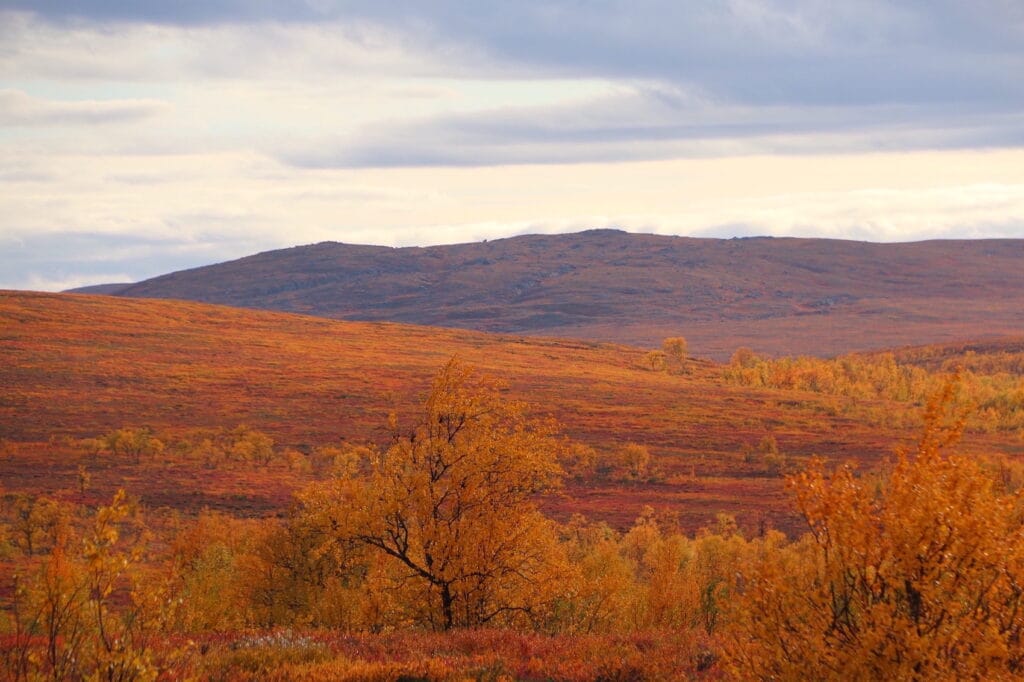
Summer and autumn colours (June–October) is the best time to walk the marked hiking trails on foot. Fell stream water is generally very clean, berry-picking and nature watching are at their best, and the autumn colours are spectacular. During the midnight sun in June and July the sun does not set at all, which makes the fell landscapes truly extraordinary.
Winter and spring (November–April) means an extensive cross-country skiing trail network and snowshoe routes in Saariselkä. In winter, the Rautulampi loop is a popular ski touring route. Temperatures can be very low, but the wilderness huts provide warmth and shelter.
Practical tips for your hike
Maps. Luontoon.fi has route information and hut details. Retkikartta.fi is a good digital map service. For paper maps, the Karttakeskus Urho Kekkonen National Park outdoor map (1:100,000) or the Calazon map (1:50,000) are recommended.
Kiehinen visitor centre. The Urho Kekkonen National Park visitor centre Kiehinen, located in Saariselkä, provides guidance on route planning and practical matters related to bookable huts.
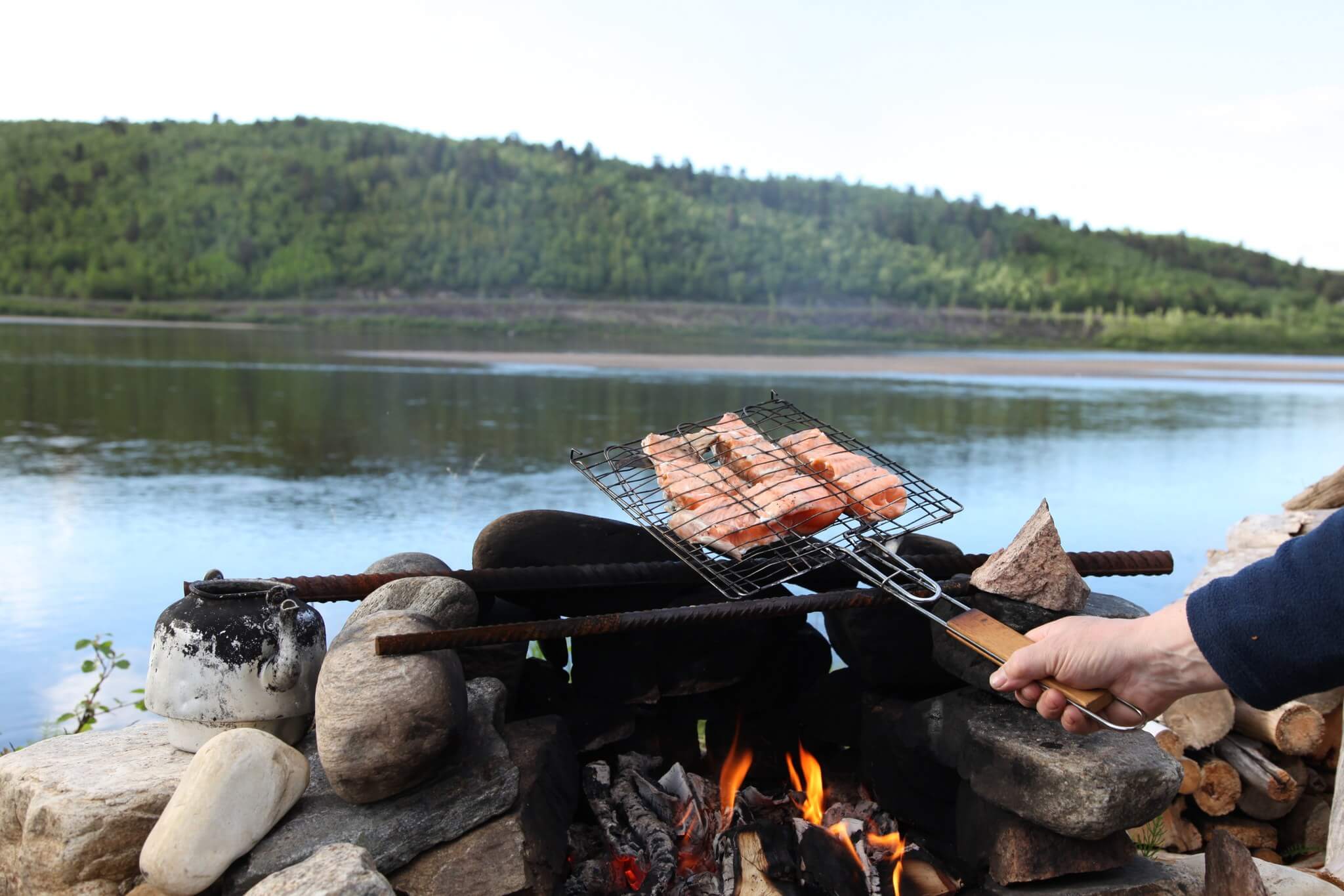
Everyman’s rights apply. Camping is permitted in the national park, and most marked routes have official campsites with fire pits. Firewood is usually available in the open hut woodsheds, but hikers should come prepared with their own fire-starting equipment.
Mobile coverage is poor in most of the park. For longer hikes, download offline maps and let someone know your plans before you set off.
Note on stream crossings. The routes include stream and river crossings that do not always have bridges. In summer, crossings can usually be made on stepping stones or by wading. It is worth packing sandals for crossings.
Accommodation in Saariselkä before and after your hike
Saariselkä is a natural base for hiking in the UKK park. The Kiilopää trailhead, the main starting point for hikes, is approximately 15 km south of Saariselkä, and Saariselkä’s own gateway is within walking distance of the village centre.
Kuukkeli offers a wide range of accommodation to suit different groups. Teerenpesä Suite rooms and apartments are ideal for larger groups and families, while the cosy Hirvas Suite is perfect for couples. Those looking for something more impressive can choose Villa Aurora Pupula or Aurora Resort. You can find all accommodation options in the booking system:
Bistro & Café Kuukkeli is a convenient spot to enjoy a proper meal before your hike or to relax after returning. Equipment and gear rental is available at Kesport, located under the same roof at Kauppakeskus Kuukkeli.
How to get to Saariselkä?
The nearest airports are in Ivalo (approximately 30 km from Saariselkä) and Rovaniemi. Daily buses run along Route 4 from both Rovaniemi and Ivalo, with direct connections to Saariselkä, Kiilopää and Tankavaara. If arriving by car, note that during the busiest seasons such as autumn colours, parking at the most popular trailheads can be difficult to find.
Summary: why choose Urho Kekkonen National Park?
Urho Kekkonen National Park combines an excellent trail network, a comprehensive hut infrastructure and exceptionally beautiful Lapland wilderness scenery. Hikers can choose anything from a two-hour walk to a week-long wilderness trek, all from the same starting point. Saariselkä and Kauppakeskus Kuukkeli provide everything needed before and after the hike: accommodation, food, equipment and transport services.